
Laurel Fork Campsite, Cane Brake, United States
Basic Info
Distance from the campground to Cane Brake: 26.89 mi
Accommodation Types
Tent allowed
RV allowed
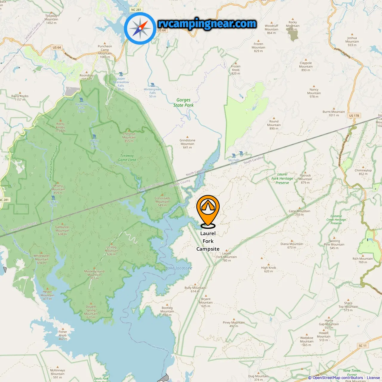
Downloadable Map 1 » Laurel Fork Campsite
Location of Laurel Fork Campsite
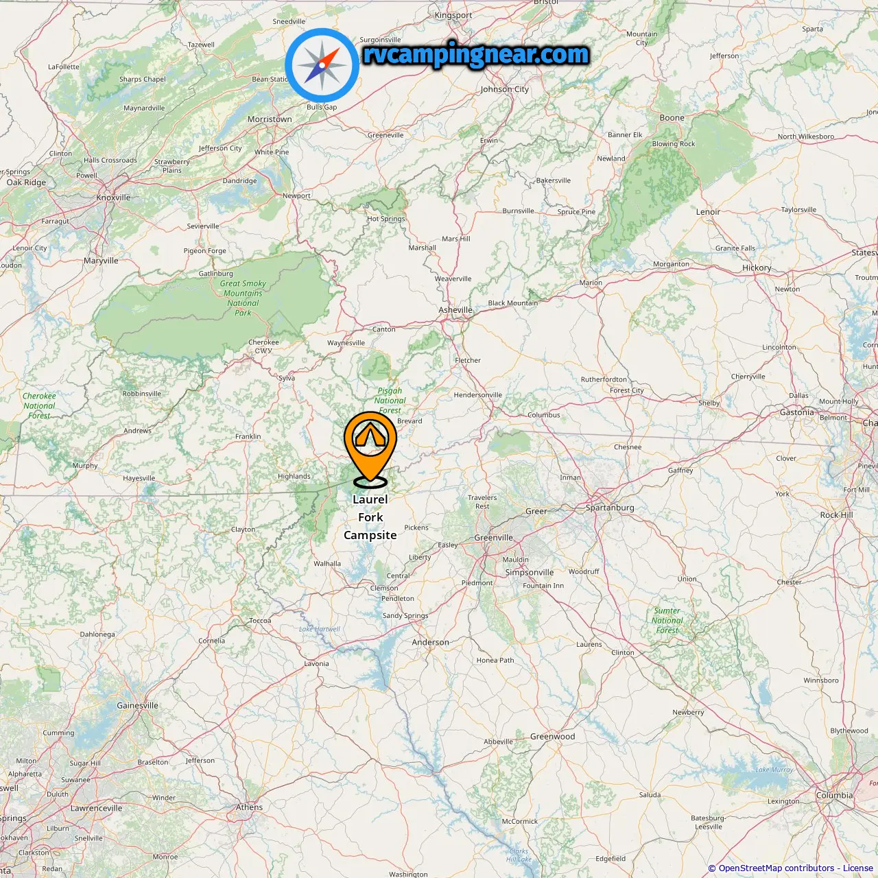
Downloadable Map 2 » Laurel Fork Campsite
Location of Laurel Fork Campsite
More campgrounds in Cane Brake
Find campgrounds in these cities near Cane Brake
Campgrounds in Round Mountain (6.59 mi from Cane Brake)
Campgrounds in Reid (13.25 mi from Cane Brake)
Campgrounds in Bear Wallow Hollow (17.7 mi from Cane Brake)
Campgrounds in Rocky Bottom (15.22 mi from Cane Brake)
Campgrounds in Lake Toxaway (15.3 mi from Cane Brake)
Campgrounds in Union (20.31 mi from Cane Brake)
Campgrounds in Nimmons (21.86 mi from Cane Brake)
Campgrounds in Line Runner Ridge (10.92 mi from Cane Brake)
Campgrounds in Rosman (11.4 mi from Cane Brake)
Campgrounds in Sapphire (21.07 mi from Cane Brake)
Campgrounds in Jocassee (37 mi from Cane Brake)
Campgrounds in Eastatoe (37.49 mi from Cane Brake)
Campgrounds in Sunset (23 mi from Cane Brake)
Campgrounds in Cherryfield (13.03 mi from Cane Brake)
Campgrounds in Canaan (21.59 mi from Cane Brake)