
State Line, Duers Neck Landing, United States
Basic Info
Accommodation Types
Tent allowed
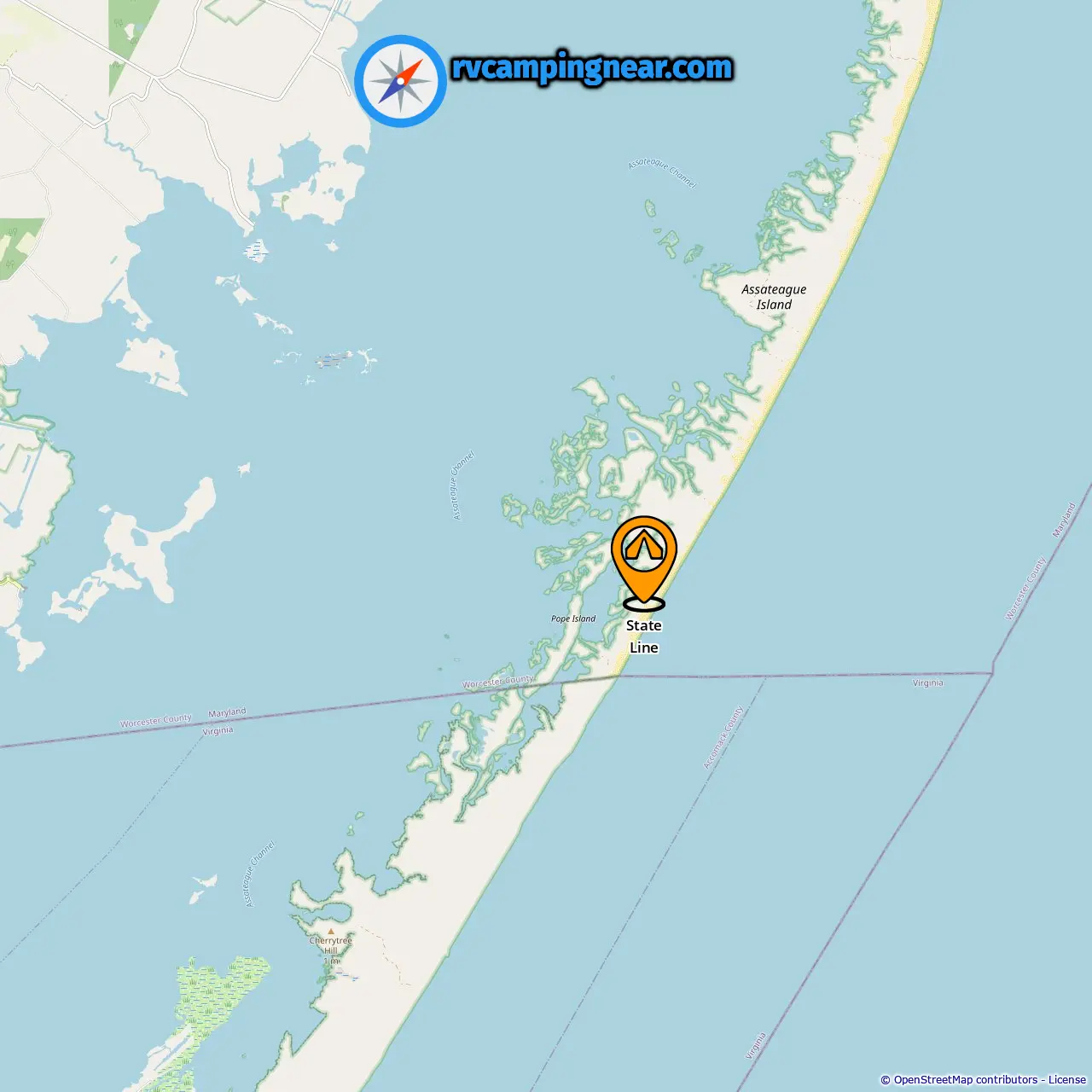
Downloadable Map 1 » State Line
Location of State Line
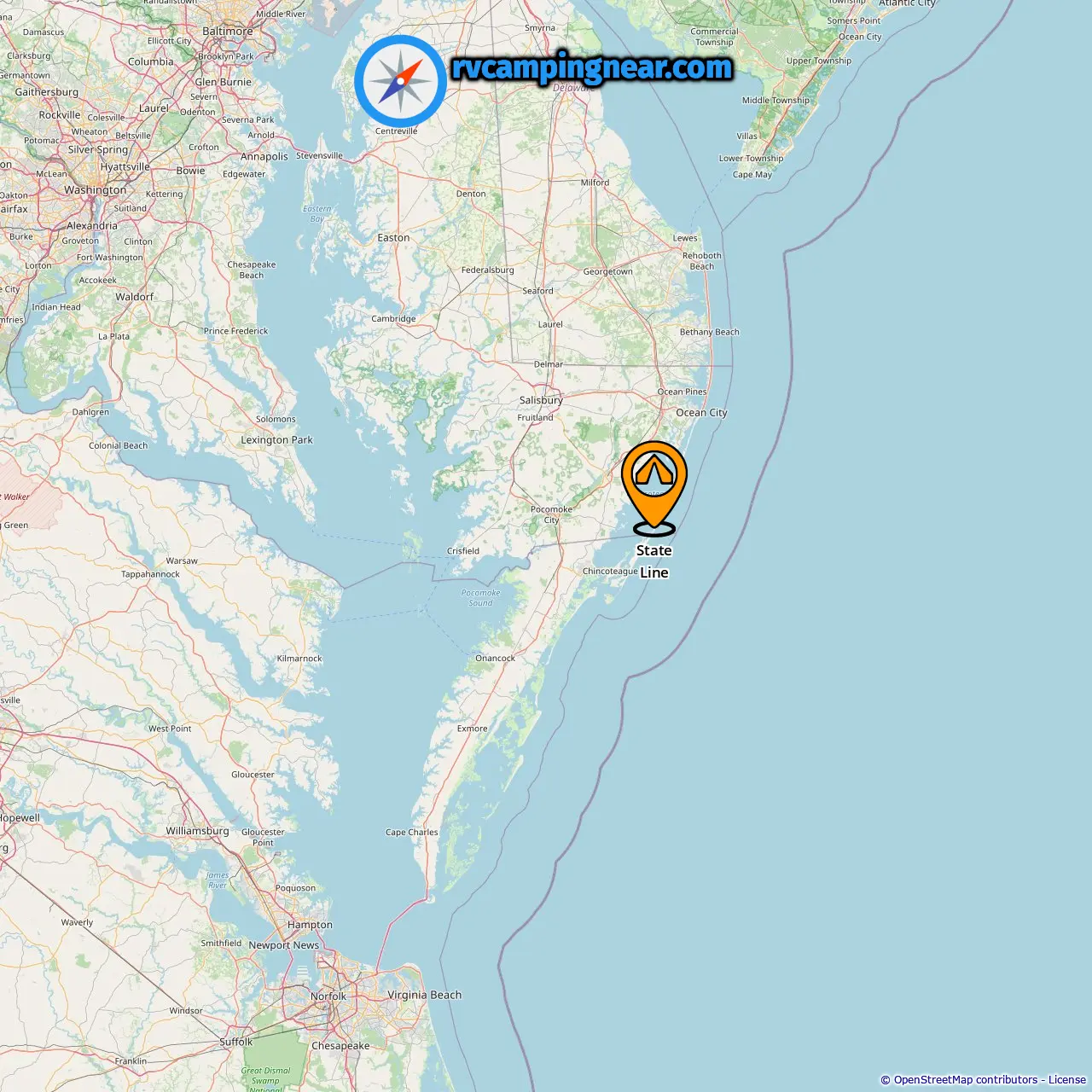
Downloadable Map 2 » State Line
Location of State Line
More campsites in Duers Neck Landing
Find campsites in these cities near Duers Neck Landing
Campsites in Figgs Landing (3.98 mi from Duers Neck Landing)
Campsites in Bayview (Historical) (9.76 mi from Duers Neck Landing)
Campsites in Snow Hill (7.56 mi from Duers Neck Landing)
Campsites in Harmon Landing (10.81 mi from Duers Neck Landing)
Campsites in Milburn Landing (26.14 mi from Duers Neck Landing)
Campsites in Newark (15.24 mi from Duers Neck Landing)
Campsites in Genezer Estates (31.58 mi from Duers Neck Landing)
-
Assateague Island National Seashore Campground »
8.54 mi from Genezer Estates
-
Bayside - Assateague Island National Seashore »
8.1 mi from Genezer Estates
-
Sinepuxent District Ranger Station/Campground Office »
7.13 mi from Genezer Estates
-
Oceanside - Assateague Island National Seashore »
8.35 mi from Genezer Estates
-
Horse Camping »
8.67 mi from Genezer Estates
-
Back Country Camping - Tingles Island »
8.76 mi from Genezer Estates
-
Little Levels »
Campsites in Deep Hole (31.94 mi from Duers Neck Landing)
Campsites in Chincoteague Island (31.69 mi from Duers Neck Landing)
Campsites in Chincoteague (31.36 mi from Duers Neck Landing)
Campsites in Horntown (18.84 mi from Duers Neck Landing)
Campsites in Golf Club Shores (28.99 mi from Duers Neck Landing)
Campsites in Black Point Landing (33.83 mi from Duers Neck Landing)
Campsites in Pocomoke City (18.32 mi from Duers Neck Landing)
Campsites in Lewis Corner (26.09 mi from Duers Neck Landing)